REACHING NORTH We had made arrangements with one of the local mountain guides to hire a Jeep for the day, but he turned up jeep-less at 8:30 with a story about his grandfather dying.
True or not it was hard to say, so we arranged another Jeep and set off with a different driver to see how far north we could get.
Just out of Ganesh, at the edge of the river, we stopped for a few minutes to look at some ancient rock drawings of ibex that have been etched into the boulders beside the river, and then, a little further on, at an abandoned ruby mine in a cliff next to the road.
The path that the road took was winding and spectacular: cut into the sheer rock high above the river in some places; following the contours of alluvial terraces in others. There were several small landslides where rocks had crashed down onto the road, but all in all, the Karakoram Highway seemed to be in pretty good condition.
The views became more and more spectacular as we moved north towards the jagged Passu massive, rising sheer from the floor of the valley.
We stop for chai at Ghulmet – a small frozen hamlet at the centre of a wide area of river flats – then moved on deeper into the mountains. The road became progressively more snow-covered and slippery, although nothing to worry about really.
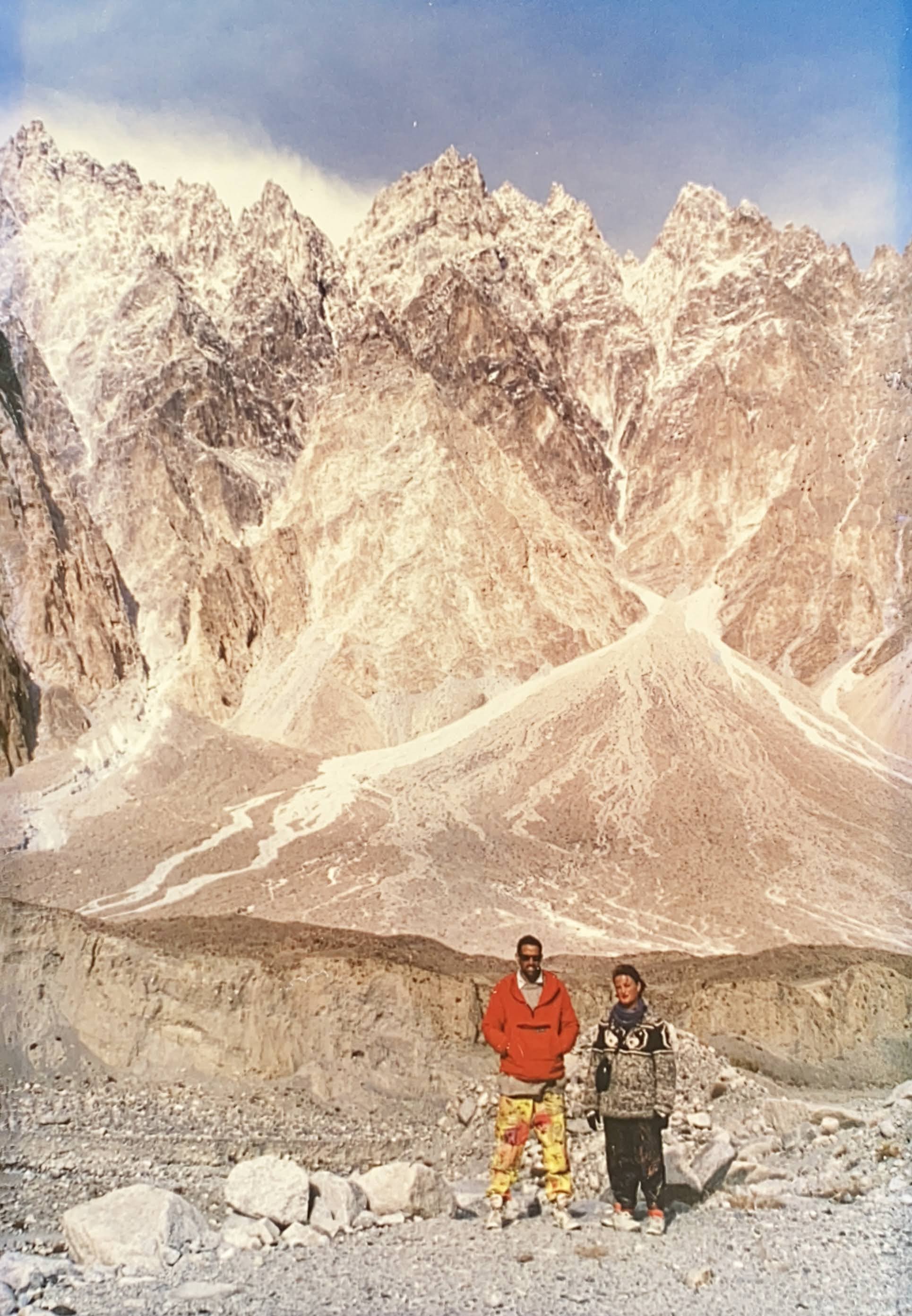
We stopped for a photo session high above the valley, where the road took a sharp turn around a shoulder of running shingle. The valley before us was hemmed in by sheer peaks of rock and everything around was frozen. The waterfalls were solid ice and the peaks and even the sky seem frozen solid and immobile until spring.
A light haze covered the sun, throwing the whole scene into a kind of grey cast, merging the colours to an almost single shade as if we were looking at a lithograph or a black and white negative.
We reached Passu – locked in perpetual shadow until the days lengthen – and then a little further on, we stopped at the Batura River, flowing down from the mighty Batura Glacier. We left the jeep and walked up the riverbed towards the glacier. The valley was in shadow and as we neared the glacier the river began to freeze over until we could walk along upon it
The landscape was stupendous! Jagged spires of rock, impossibly steep, lanced into a sky of such cobalt blue and it almost hurt to look at it. The land was devoid of any vegetation – a landscape of tortured rock, freezing water, and pure air.
At the foot of the glacier, an ice cave had been formed by the combined action of melting and wind. The ice inside the cave, which was in fact a tunnel running beneath the ice to an amphitheatre of black ice and rubble, was transparent and had the colour and texture of obsidian. The wind had sculpted delicate flutes and ridges across its surface, and the lumps of ice resting on the floor of the cave had the appearance of raw glass.
The cave was absolutely dry, to the point of being dusty, and the appearance of the ice didn’t seem to be due to melting as much as erosion by wind-driven dust.
Back down at the jeep, we set off again and followed the black ribbon of the Karakoram Highway north along the edge of the river, which was flowing rapidly southwards, as if fleeing the cold mountains and thin air of the Khunjerab Pass.
John and Magnus began to make noises about turning back, so we stopped at the mouth of a gorge and turned around. We were at an altitude of about 11,000 feet and at a latitude of approximately 37 degrees north: the zenith of our Pakistan trip.
We spent a few minutes there throwing rocks into the copper-green water of the river and breathing in lungfuls of air so clean and cold that it was intoxicating, then turned and headed south.
At Ghulmet, we stopped again for some soup and chapatis then continued on back down to Karimabad.
